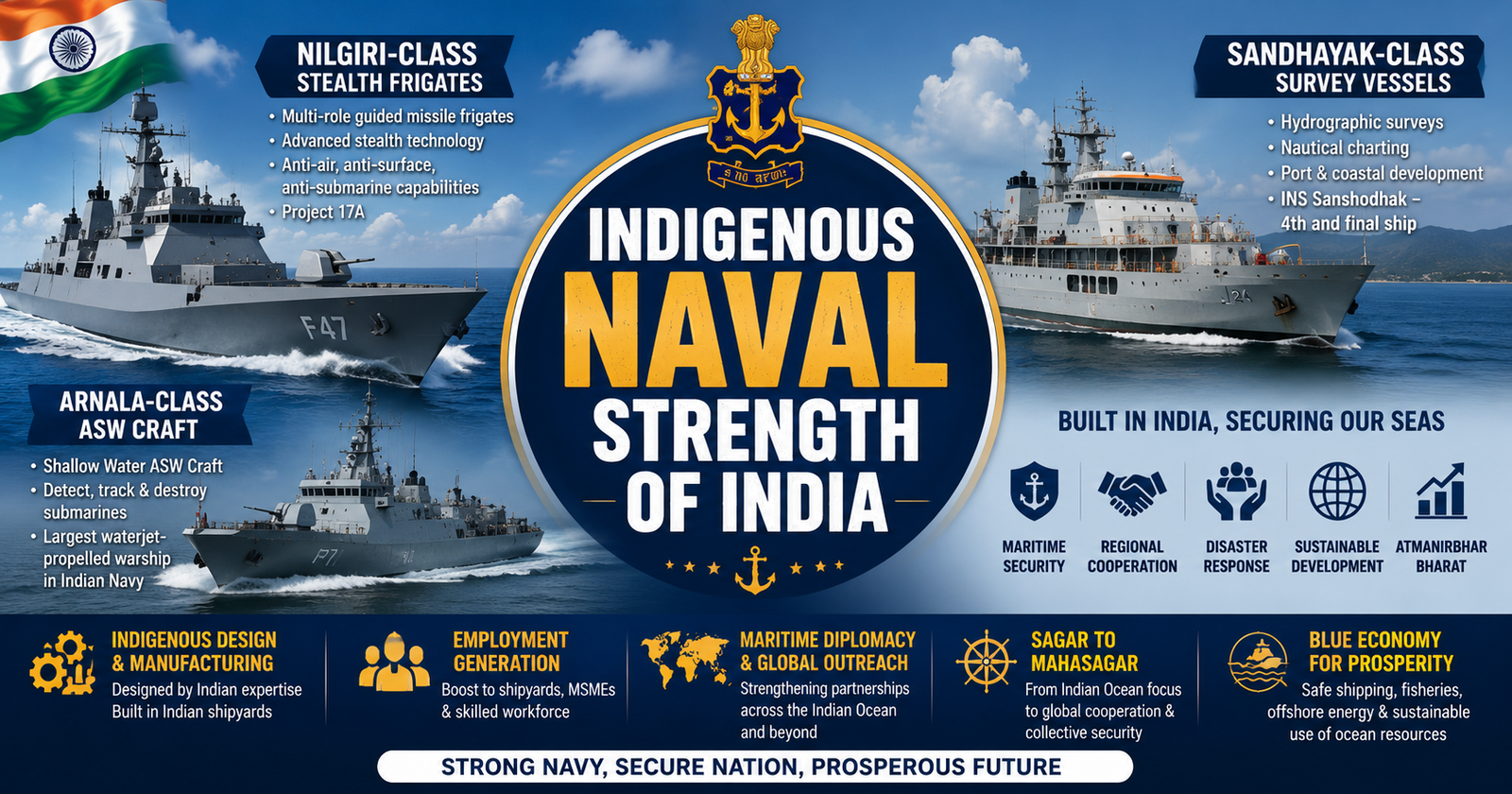
Explore indigenous naval strength of India through Nilgiri, Sandhayak and Arnala classes, alongside SAGAR and MAHASAGAR, strengthening maritime security, Blue Economy and Aatmanirbhar Bharat.
Syllabus Areas:
GS III - Science and Technology, Defence
The Government of India highlighted the growing strength of the Indian Navy through the induction of indigenous naval platforms—Nilgiri-class Stealth Frigates, Sandhayak-class Survey Vessels (Large), and Arnala-class Anti-Submarine Warfare (ASW) Shallow Water Crafts. These ships strengthen India's maritime security and promote Aatmanirbhar Bharat in defence manufacturing.
The Indian Navy is a primary security provider in the Indian Ocean Region. It safeguards a coastline of about 11,098 kilometres, an Exclusive Economic Zone of nearly 2.4 million square kilometres, and sea lanes carrying close to 90 per cent of India's trade by volume. Achieving this requires a balanced fleet, with each class of warship contributing to a distinct layer of maritime security. In India, four new-generation indigenous naval platforms inducted in just one month now bring this layered approach to life.
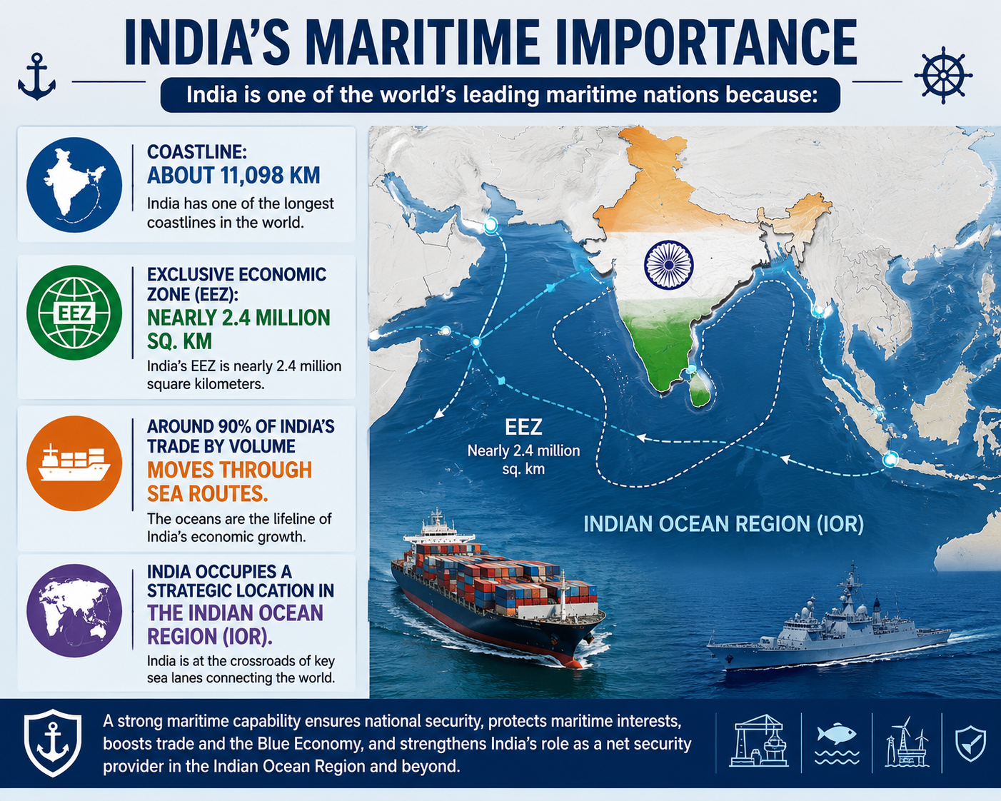
Therefore, India requires a layered naval capability to protect:
-
Maritime trade
-
Offshore assets
-
Energy routes
-
Fisheries
-
Coastal population
-
Strategic interests in the Indo-Pacific
India’s Layered Naval Capability:
Layered Naval Capability means deploying different classes of ships, each performing a specialized role to provide comprehensive maritime security.
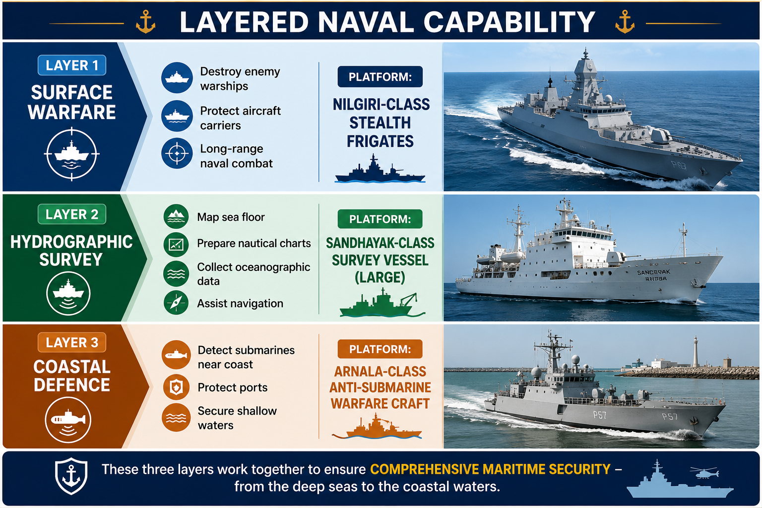
India's Three Indigenous Naval Platforms
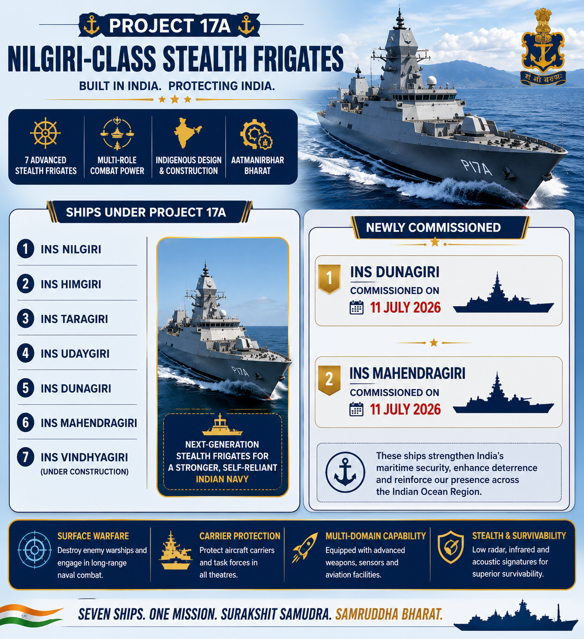
1. Nilgiri-Class Stealth Frigates (Project 17A)
What are they?
These are India's newest multi-role guided missile stealth frigates built under Project 17A.
They form the backbone of India's surface combat fleet.
Major Roles
-
Surface warfare, Anti-air warfare, Anti-submarine warfare, Escort aircraft carriers, Protect Sea Lines of Communication (SLOCs), Long-range deployments.
Stealth Frigate:
A stealth frigate is a medium-sized naval warship designed to be much harder to detect by enemy radar, sonar, infrared sensors, and even visual observation. It combines the traditional roles of a frigate—such as escorting larger ships, hunting submarines, defending against aircraft, and conducting patrols—with technologies that reduce its "signature."
For Example:
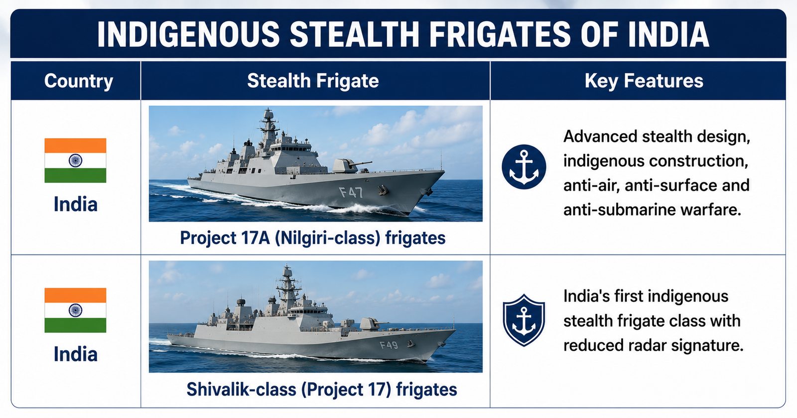
Why is Project 17A Important?
-
75% indigenous content
-
Advanced guided missile frigates
-
Designed by the Navy's Warship Design Bureau
-
Marks India's transition from a Buyer's Navy to a Builder's Navy
-
Strengthens blue-water naval capability
2. Sandhayak-Class Survey Vessel (Large)
What are Survey Vessels?
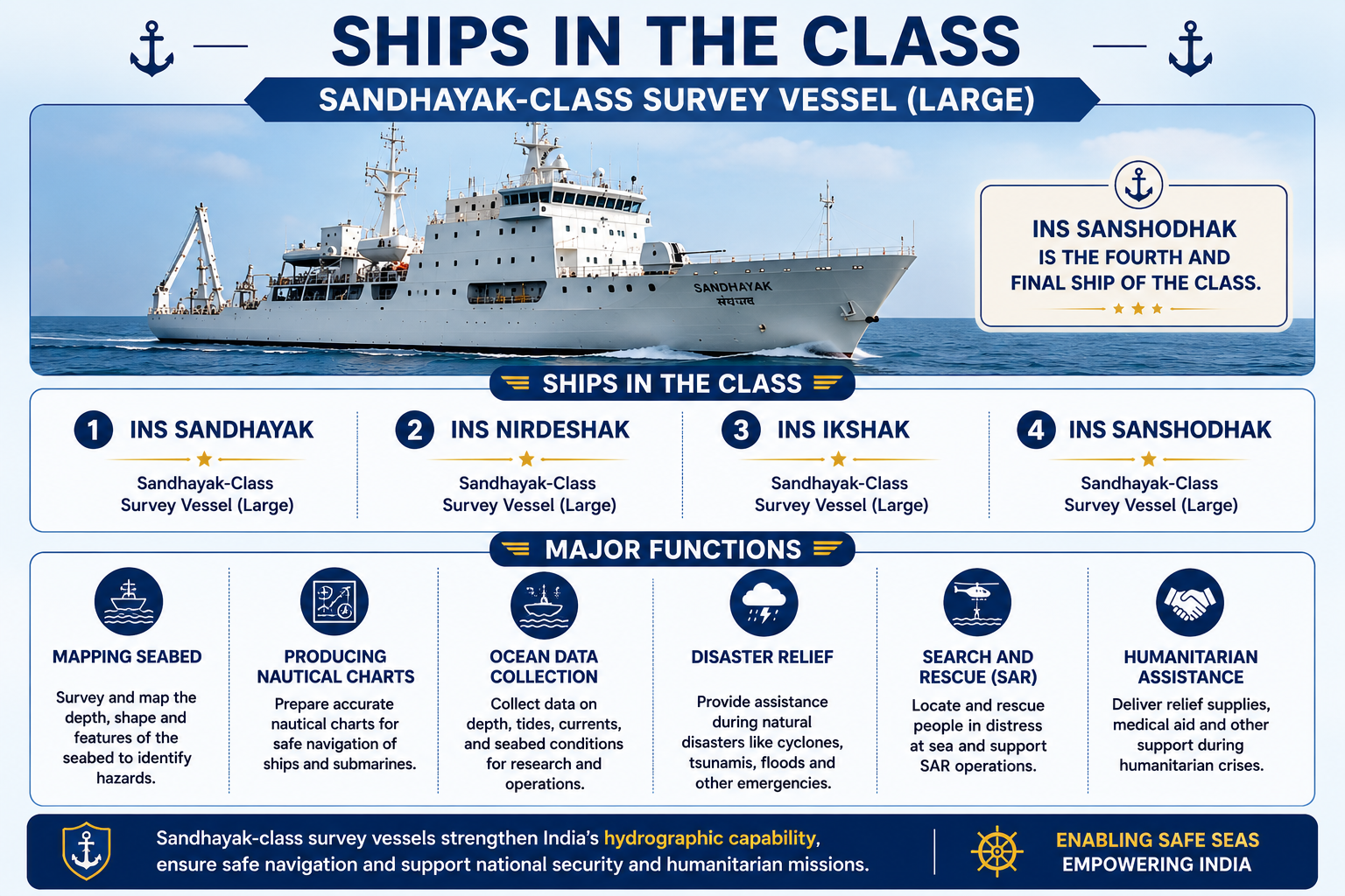
Survey vessels are specialized ships that Map the seabed, Conduct hydrographic surveys, Produce nautical charts, Study oceanographic conditions, Improve navigation safety
Why are Hydrographic Surveys Important?
-
Safe Navigation: Help prepare accurate nautical charts, identify underwater hazards, and ensure safe movement of ships.
-
Port Development: Support the construction, expansion, and dredging of ports and harbours by mapping seabed conditions.
-
Defence Planning: Provide vital seabed and coastal data for naval operations, submarine movement, and maritime security.
-
Offshore Exploration: Identify suitable locations for offshore oil & gas, wind energy, submarine cables, and marine mineral resources.
-
Blue Economy: Promote sustainable use of ocean resources by supporting fisheries, shipping, tourism, and offshore industries.
-
Maritime Domain Awareness (MDA): Enhance monitoring of ship movements, illegal activities, coastal security, and search & rescue operations.
21 June is celebrated worldwide as World Hydrography Day, and INS Sanshodhak was commissioned on the same day.
Major Functions of Survey Vessels
1. Mapping the Seabed
-
Survey and map the depth, shape, and features of the ocean floor.
-
Identify underwater hazards such as rocks, reefs, and shipwrecks.
2. Producing Nautical Charts
-
Prepare accurate nautical charts for safe navigation of naval and merchant ships.
-
Update charts regularly to reflect changes in coastal and seabed conditions.
3. Ocean Data Collection
-
Collect data on depth, tides, currents, seabed characteristics, and water conditions.
-
Supports hydrography, marine research, and naval operations.
4. Disaster Relief (HADR)
-
Provide assistance during cyclones, tsunamis, floods, and other natural disasters.
-
Deliver relief supplies and support affected coastal communities.
5. Search and Rescue (SAR)
-
Locate and rescue ships, aircraft, and people in distress at sea.
-
Coordinate emergency maritime rescue operations.
6. Humanitarian Assistance
-
Supply food, water, medicines, and medical aid during humanitarian crises.
-
Support evacuation and relief operations in India and friendly countries.
3. Arnala-Class Anti-Submarine Warfare (ASW) Shallow Water Crafts
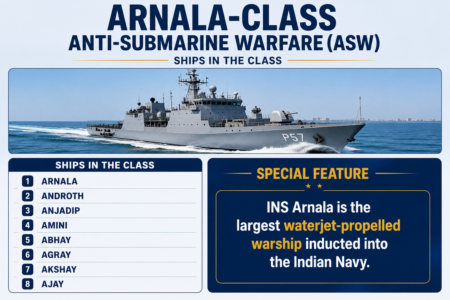
These ships protect India's coastal waters by detecting and destroying enemy submarines operating in shallow waters.
Why are they Needed?
Large destroyers and frigates cannot effectively operate in Shallow coastal waters, Narrow channels, Harbour approaches
Hence, smaller and highly manoeuvrable ASW craft are required.
Major Roles of Arnala-Class Anti-Submarine Warfare (ASW) Craft
-
Detect Submarines: Use advanced sonar systems to locate enemy submarines operating in shallow coastal waters.
-
Destroy Submarines: Engage hostile submarines using lightweight torpedoes and anti-submarine rockets.
-
Coastal Defence: Protect India's coastline, ports, and strategic coastal assets from underwater threats.
-
Harbour Security: Safeguard harbours and naval bases by preventing enemy submarine infiltration.
-
Mine Warfare Support: Assist in detecting and countering naval mines to ensure safe maritime operations.
-
Disaster Relief (HADR): Provide humanitarian assistance, relief supplies, and support during natural disasters.
-
Search and Rescue (SAR): Conduct rescue operations for ships, aircraft, and people in distress at sea
What is Anti-Submarine Warfare (ASW)?
Anti-Submarine Warfare (ASW) refers to military operations conducted to detect, track, and neutralize enemy submarines to protect naval fleets, merchant ships, ports, and coastal waters from underwater threats.
Objectives of ASW
-
Detect enemy submarines: Locate submarines using sonar and surveillance systems.
-
Track submarines: Continuously monitor submarine movements to prevent escape.
-
Neutralize submarines: Destroy or disable enemy submarines before they can launch attacks.
ASW Equipment and Platforms
1. Sonar (Sound Navigation and Ranging)
-
Uses sound waves to detect and locate submarines underwater.
-
Primary sensor for submarine detection.
2. Torpedoes
-
Self-guided underwater missiles launched from ships, submarines, or helicopters.
-
Designed to destroy enemy submarines.
3. Depth Charges
-
Explosive devices dropped into the sea.
-
Detonate at a preset depth to damage or destroy submerged submarines.
4. Anti-Submarine Rockets
-
Rocket-propelled weapons that rapidly deliver explosives or torpedoes to a submarine's location.
-
Effective against submarines detected at medium ranges.
5. Maritime Patrol Aircraft (MPA)
-
Long-range aircraft equipped with radar, sonar buoys, and torpedoes.
-
Used for wide-area submarine detection and surveillance.
Example: P-8I Poseidon aircraft of the Indian Navy.
6. ASW Helicopters
-
Helicopters equipped with dipping sonar, sonobuoys, and torpedoes.
-
Can quickly detect and engage submarines near naval task forces.
Example: MH-60R Seahawk helicopters.
Strategic Importance of India's Indigenous Naval Platforms
A. Maritime Security
-
Strengthen surface warfare, coastal defence, and anti-submarine warfare (ASW) capabilities.
-
Enhance hydrographic support through seabed mapping and navigation charts.
-
Improve Maritime Domain Awareness (MDA) for effective monitoring of India's maritime zones.
B. Aatmanirbhar Bharat
-
Promote indigenous ship design and manufacturing.
-
Reduce dependence on imported defence equipment.
-
Strengthen self-reliance in defence production and indigenous technology.
C. Blue Economy
-
Ensure safe shipping and secure maritime trade.
-
Support fisheries, offshore energy, and port development.
-
Promote sustainable management of ocean resources.
D. Employment Generation
-
Boost Indian shipyards and MSMEs.
-
Generate skilled employment in defence manufacturing.
-
Strengthen India's indigenous defence industrial ecosystem.
E. Maritime Exports
-
Indian shipyards like GRSE are exporting naval platforms to friendly countries.
-
Showcase India's growing capability in defence manufacturing and warship exports.
-
Strengthen maritime diplomacy and India's global defence presence.
SAGAR and MAHASAGAR
India's maritime vision has evolved from securing the Indian Ocean Region (IOR) to becoming a leading maritime partner across the Global South. This evolution is reflected in the transition from SAGAR (2015) to MAHASAGAR (2025).
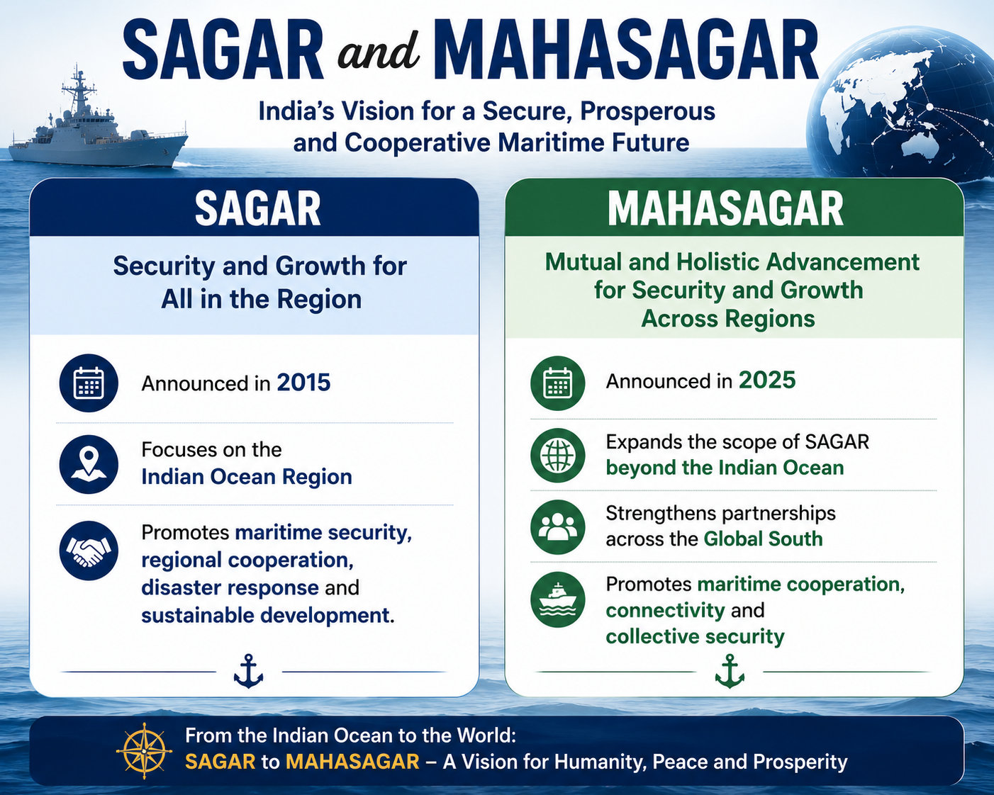
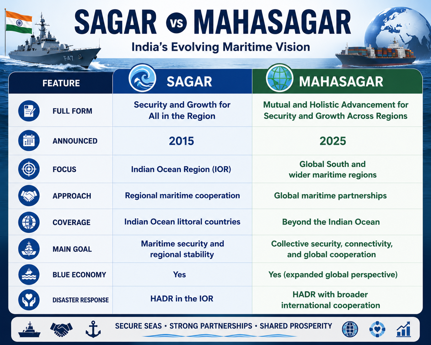
SAGAR laid the foundation for India's regional maritime strategy in the Indian Ocean, while MAHASAGAR expands this vision globally by promoting maritime security, connectivity, sustainable development, and partnerships across the Global South.
Prelims Questions:
1. With reference to India's indigenous naval platforms, consider the following statements:
-
INS Sanshodhak is the fourth and final ship of the Sandhayak-class Survey Vessel (Large).
-
INS Arnala is the largest waterjet-propelled warship inducted into the Indian Navy.
-
Nilgiri-class frigates are built under Project 15B.
Which of the statements given above is/are correct?
A. 1 only
B. 1 and 2 only
C. 2 and 3 only
D. 1, 2 and 3
Answer: B
Explanation:
-
Statement 1 is correct.
-
Statement 2 is correct.
-
Statement 3 is incorrect. Nilgiri-class frigates are built under Project 17A, while Project 15B relates to Visakhapatnam-class destroyers.
2. Which of the following activities are supported by Hydrographic Surveys?
-
Preparation of nautical charts
-
Port development
-
Offshore energy exploration
-
Maritime Domain Awareness
Select the correct answer using the code below.
A. 1 and 2 only
B. 2 and 4 only
C. 1, 2 and 3 only
D. 1, 2, 3 and 4
Answer: D
Explanation: Hydrographic surveys support all the above functions.