An overview of Kailash Manasasarovar’s rugged topography, geomorphological features, pilgrimage routes, and major hazards including landslides, flash floods, earthquakes, glacial lake outbursts, and extreme weather events.
Syllabus Areas:
GS I - Geography
GS III - Environment and Disaster Management
Points To Be Covered:
- Why is it in News?
- Key Terminology Related to Manasasarovar Yatra
- The Topography of the Kailash Mansarovar Yatra, Plate Tectonics & Geographical Activity In This Area and Major Disasters in the Kailash–Mansarovar Region
- Mythological History of Kailash–Mansarovar and Travel route to reach the Kailash–Manasarovar Routes and Mount Kailash Parikrama / Kora
- From Salt & Wool to EVs: The Changing Face of Rasuwagadhi
Watch Video On Manasasarovar Major Disaster:
Topography of the Kailash Mansarovar Yatra
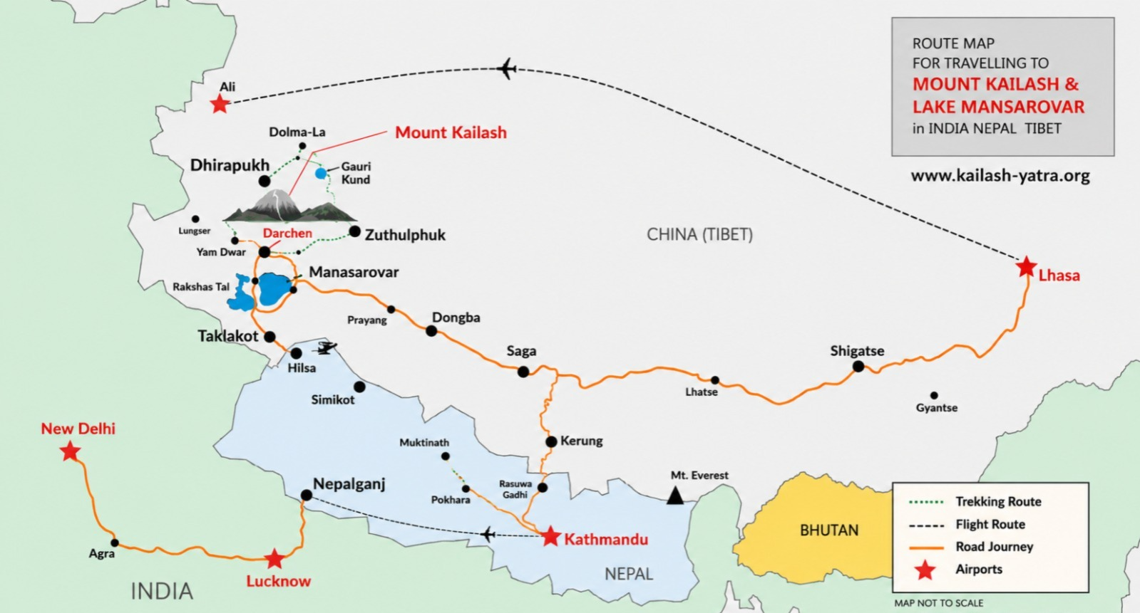
The pilgrimage takes place across the high-altitude Himalayan–Tibetan landscape, characterized by enormous elevation differences, steep mountain slopes, deep valleys, glaciers, high passes and extensive areas of permafrost.
-
High-altitude terrain: Mount Kailash (6,638 m) and Lake Mansarovar (≈4,590 m) lie in an extreme high-altitude environment with thin air, cold temperatures and sparse vegetation.
-
Rugged Himalayan relief: The route passes through steep slopes, narrow valleys and deep gorges, making the terrain highly susceptible to landslides and erosion.
-
High mountain passes: Routes involve high passes such as Lipulekh Pass (≈5,000 m), which face snowstorms, avalanches and rapid weather changes.
-
Glaciers and snowfields: The Trans-Himalayan landscape contains glaciers, permanent snow and frozen ground, contributing to geomorphological instability.
-
River valleys and gorges: Rivers such as the Bhote Koshi and Trishuli flow through steep-gradient valleys, allowing floods, landslides and debris flows to become rapidly destructive.
Plate Tectonics & Geographical Activity
-
Active plate collision: The region lies where the Indian Plate collides with the Eurasian Plate, making the Himalayas tectonically active.
-
Continuous movement: The Indian Plate moves northward by about 40–50 mm/year, continuously deforming the Himalayan crust.
-
Ongoing uplift: The Himalayas are still rising by a few millimetres each year, making them one of the world’s most dynamic mountain systems.
-
Active faults: Major structures such as the Main Himalayan Thrust (MHT), Main Central Thrust (MCT), Main Boundary Thrust (MBT) and Main Frontal Thrust (MFT) accommodate this deformation.
-
High earthquake risk: Continuous plate convergence builds enormous stress, making the Himalayan region highly earthquake-prone.
-
Young & fragile mountains: The Himalayas are geologically young, with fractured rocks and unstable slopes, increasing susceptibility to landslides.
-
Extreme elevation: Mount Kailash (6,638 m) and Lake Mansarovar (≈4,590 m) illustrate the region’s extreme altitude and relief.
-
Steep river valleys: Rivers descend rapidly through narrow valleys, giving them strong erosive and flood-producing potential.
-
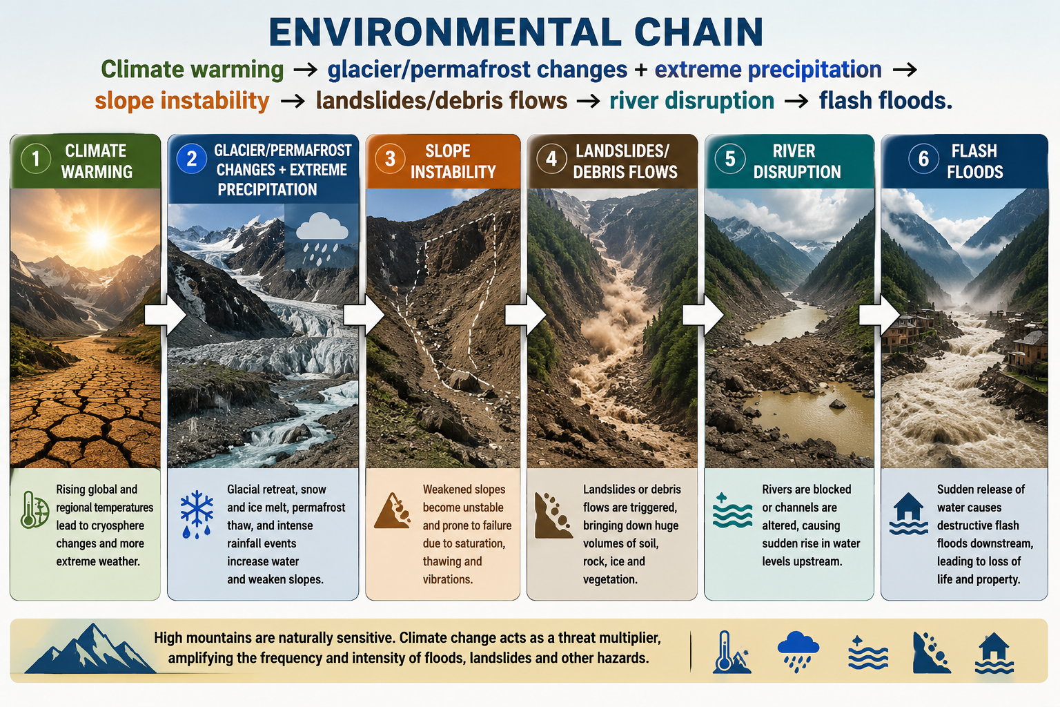
Multiple hazards interact: Tectonic activity, steep slopes, rainfall, glaciers, snowmelt and river erosion can combine to trigger landslides, debris flows, avalanches and flash floods.
Major Disasters in the Kailash–Mansarovar Region & Himalayan Corridor
-
1998 – Malpa Landslide, Uttarakhand: A massive landslide buried Malpa village, killing around 221 people, including about 60 Kailash Mansarovar pilgrims.
-
2013 – Kedarnath Disaster, Uttarakhand: Extreme rainfall and flash floods triggered widespread flooding and landslides, causing thousands of deaths and extensive destruction.
-
2021 – Chamoli Flash Flood, Uttarakhand: A rock–ice avalanche triggered a devastating flash flood, killing or leaving missing more than 200 people and damaging hydropower projects.
-
2023 – South Lhonak GLOF, Sikkim: A Glacial Lake Outburst Flood caused severe flooding, killing around 179 people and damaging major infrastructure.
-
2025 – Rasuwagadhi Flood, Nepal–Tibet Border: A sudden glacial/supraglacial lake outburst caused a flash flood that killed at least 9 people, with others missing, and destroyed the Friendship Bridge and infrastructure.
-
2026 – Nepal–Tibet Border Disaster: A massive glacial collapse, landslide/debris flow and flash flood devastated the Rasuwagadhi–Bhote Koshi corridor, killing 160+ people and leaving hundreds missing, including Kailash Mansarovar pilgrims.