Himalayan Tectonics
GS I - Geography
A structural geologist who has studied the Himalayas for over four decades has recently compiled a detailed, hand-drawn geological map of the Himalayan mountain belt. The map synthesises decades of research, integrating modern and classical geological tools to understand the structure, evolution, and complexities of the Himalayas from Afghanistan to Myanmar.
Understanding the Core of the Research
- The central aim of this research is to understand how mountains are made — in scientific terms, to decode the process of orogenesis.
The Himalayas:
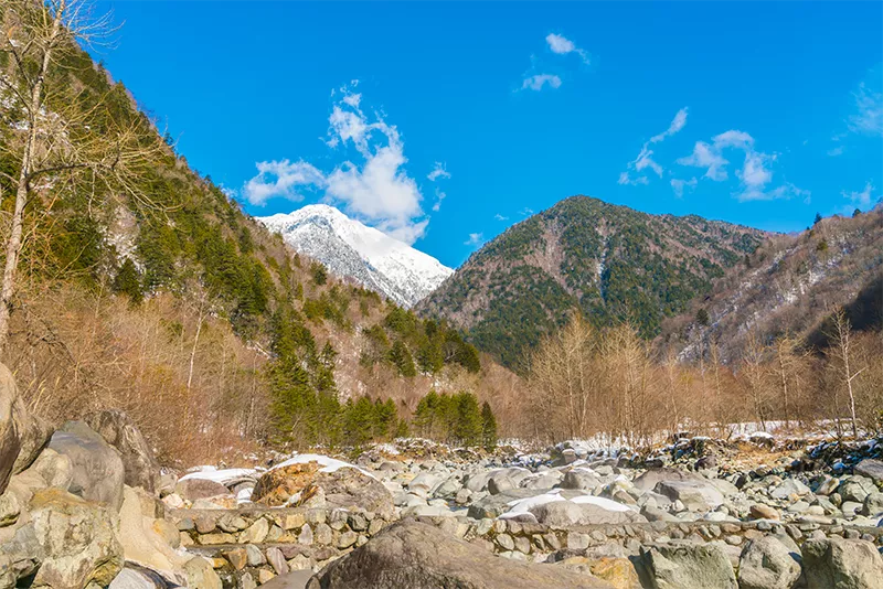
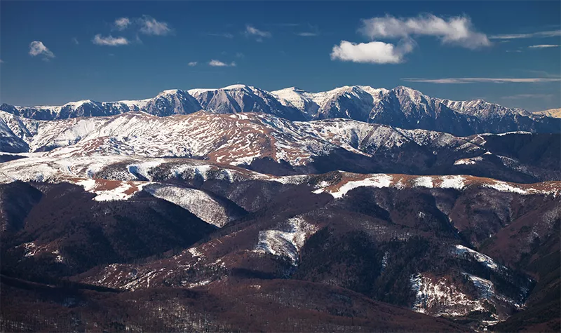
- The Himalayas serve as an ideal laboratory for this purpose because they are the youngest and most active mountain range on Earth, formed by the collision of two continental plates — the Indian Plate and the Eurasian Plate — around 50 million years ago, a process still continuing today.
- To reconstruct the story of their formation, the geologist used a combination of field mapping, structural geology, strain analysis, thermobarometry, and uranium–lead (U–Pb) geochronology.
- Each technique contributes a piece of the puzzle:
- field mapping gives the spatial relationship of rocks;
- strain analysis quantifies deformation;
- thermobarometry tells us the temperature and pressure at which rocks formed;
- U–Pb dating fixes the timing of these events.
- Together, they allow geologists to "unwind time" and rebuild the sequence of mountain-building events.
Key Features of Himalayan Tectonics
- Unlike ancient mountain belts such as the Caledonides in Europe or the Alps, which have undergone multiple plate collisions and rotations, the Himalayas are comparatively simple in structure.
- Their simplicity lies in the fact that they result from a single, head-on collision between the Indian and Eurasian plates.
- Yet, on a smaller scale, the Himalayas reveal remarkable complexity, particularly at their eastern and western ends.
- At the western edge, near Nanga Parbat in Pakistan, the mountain belt bends sharply — nearly 90 degrees — forming what geologists call a syntaxis.
- Similarly, at the eastern end, near Namcha Barwa in Tibet, the range bends again.
- These two regions, known as the Nanga Parbat and Namcha Barwa syntaxes, are among the most dynamic parts of the Himalayas.
- They exhibit the fastest uplift and exhumation rates on Earth, with rocks formed deep within the crust (25–30 km below the surface) now exposed at altitudes above 6,000 metres.
- In these regions, metamorphism — the process by which rocks are altered by heat and pressure — is very young and still ongoing.
- For instance, the yellow band near the summit of Mount Everest is a Cambrian limestone that has been metamorphosed into marble.
Thus, while the Himalayas as a whole are geologically young and relatively straightforward, their extremities record some of the most intense crustal deformation and metamorphic activity in the world.
Evolution of Geological Mapping
- The study of mountain-building relies heavily on geological mapping, a discipline that has evolved over centuries.
- The first comprehensive geological map was made in the early 19th century by William Smith in England, marking the beginning of modern geology.
- Over time, many nations institutionalised mapping through geological surveys.
- India’s Geological Survey (GSI), one of the oldest and largest, has been continuously mapping the subcontinent for over a century.
- Earlier, geologists would physically traverse mountains, collecting data by hand — a slow, exhaustive process that required skill and endurance.
- Today, satellite imagery and digital base maps (such as Google Earth) have transformed this work.
- While these technologies allow broad visualisation and save time, fieldwork remains irreplaceable.
- Only through direct observation can geologists understand the three-dimensional relationships between rock layers.
- To this, modern science adds a fourth dimension — time, made possible by radiometric dating methods such as U–Pb geochronology.
The Hand-Drawn Map of the Himalayas
- After decades of field research across Zanskar, Garhwal, Nepal, Bhutan, and the Karakoram, the geologist compiled a comprehensive, hand-drawn map of the Himalayas — a modern homage to Augusto Gansser’s 1964 map, Geology of the Himalayas.
- The new map spans from the Afghanistan–Pakistan border in the west to the Indo–Myanmar ranges in the east, and from the Pamir Mountains in the north to the Salt Ranges and Indian plains in the south.
- The map, 3.5 metres long and coloured using about 100 crayons, was later digitised in collaboration with the Geological Survey of Canada and printed at the Sorbonne in Paris.
- It visually integrates lithological, structural, and chronological data from across the entire range — a feat no digital system can replicate in nuance and human interpretation.
- While compiling it, the researcher discovered notable knowledge gaps, particularly along the India–Pakistan ceasefire line, where geological studies remain limited due to inaccessibility.
- The junction between Nanga Parbat’s young metamorphic rocks and the older rocks of Kashmir, Zanskar, and Ladakh remains poorly understood.
- In Pakistan, the Kohistan Island Arc, a remnant volcanic arc caught between the Indian Plate and the Karakoram, is present — but this arc vanishes eastward near Dras in Ladakh, suggesting significant tectonic discontinuity.
- Even the shelf carbonate sequences seen in Zanskar are missing in Pakistan, indicating differences in crustal evolution across the syntaxis.
Geological Significance
- The Himalayas, due to their relative geological youth and accessibility, provide scientists with a living example of how continents collide and mountains grow.
- They are critical to understanding plate tectonics, metamorphism, crustal deformation, and the relationship between tectonics, erosion, and climate.
- The study of syntaxes like Nanga Parbat and Namcha Barwa deepens our understanding of how stress, uplift, and exhumation interact to shape the Earth's surface.
- Moreover, geological mapping has implications far beyond academic curiosity.
- It supports earthquake hazard assessment, resource exploration, and land-use planning in the fragile Himalayan ecosystem.
- The integration of classical fieldwork with advanced geochronology represents the future of structural geology — where precision meets context.